A sister chronicle · East Bay peninsula · of1.dev lane
Richmond
Shoreline under pressure — told without flinching. Chochenyo land first, then rails and oil, then the wartime city that remade itself, then housing that sorted people by race, then the refinery that never left, then a Portside tech turn that is lease-recorded but still only half-announced. Good and bad.
Andrew Lazo · DruskiSister to West Oaklandv0.1.1 · Sep 2026
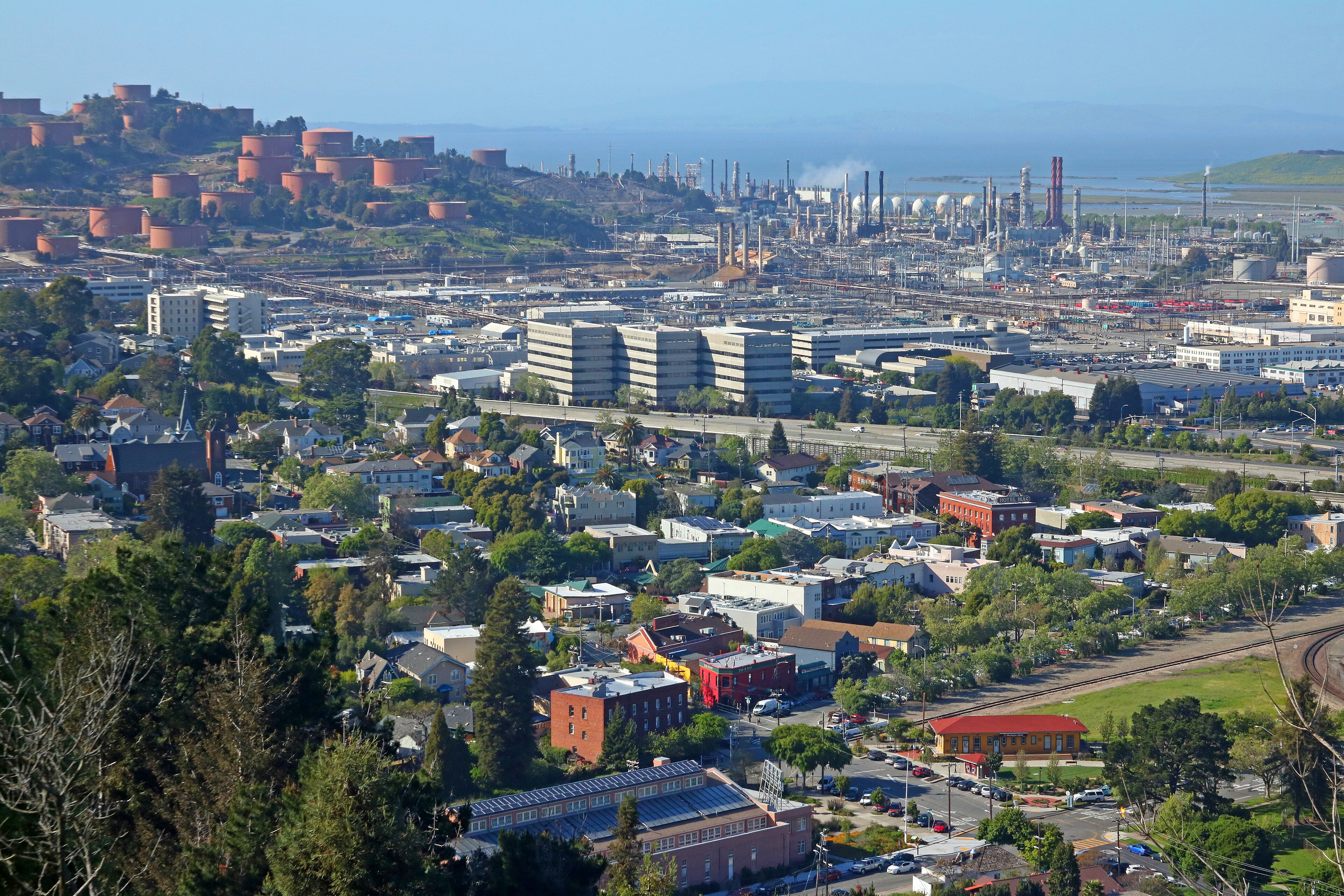
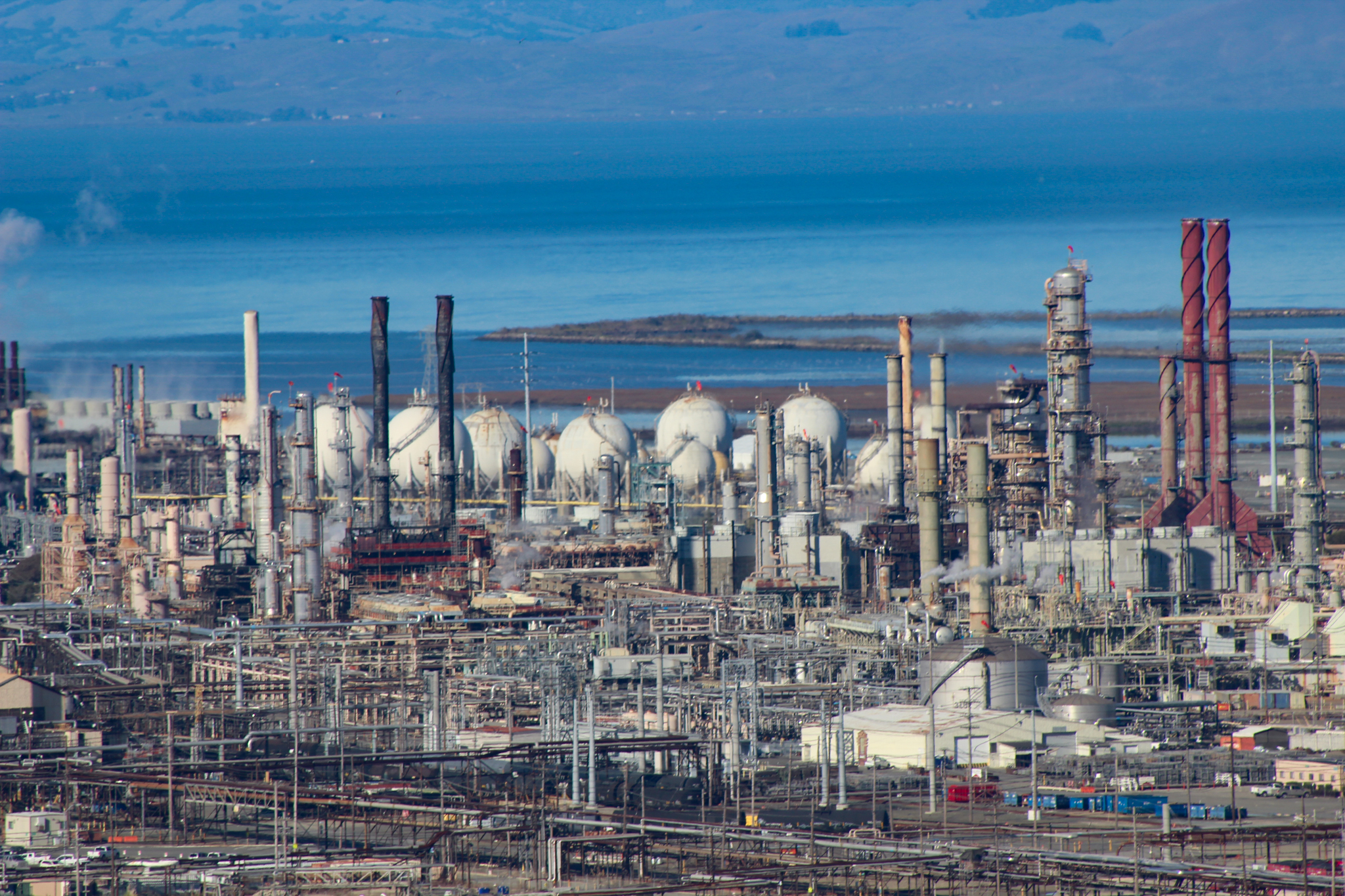
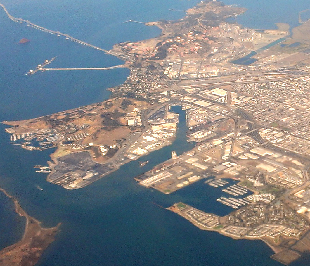
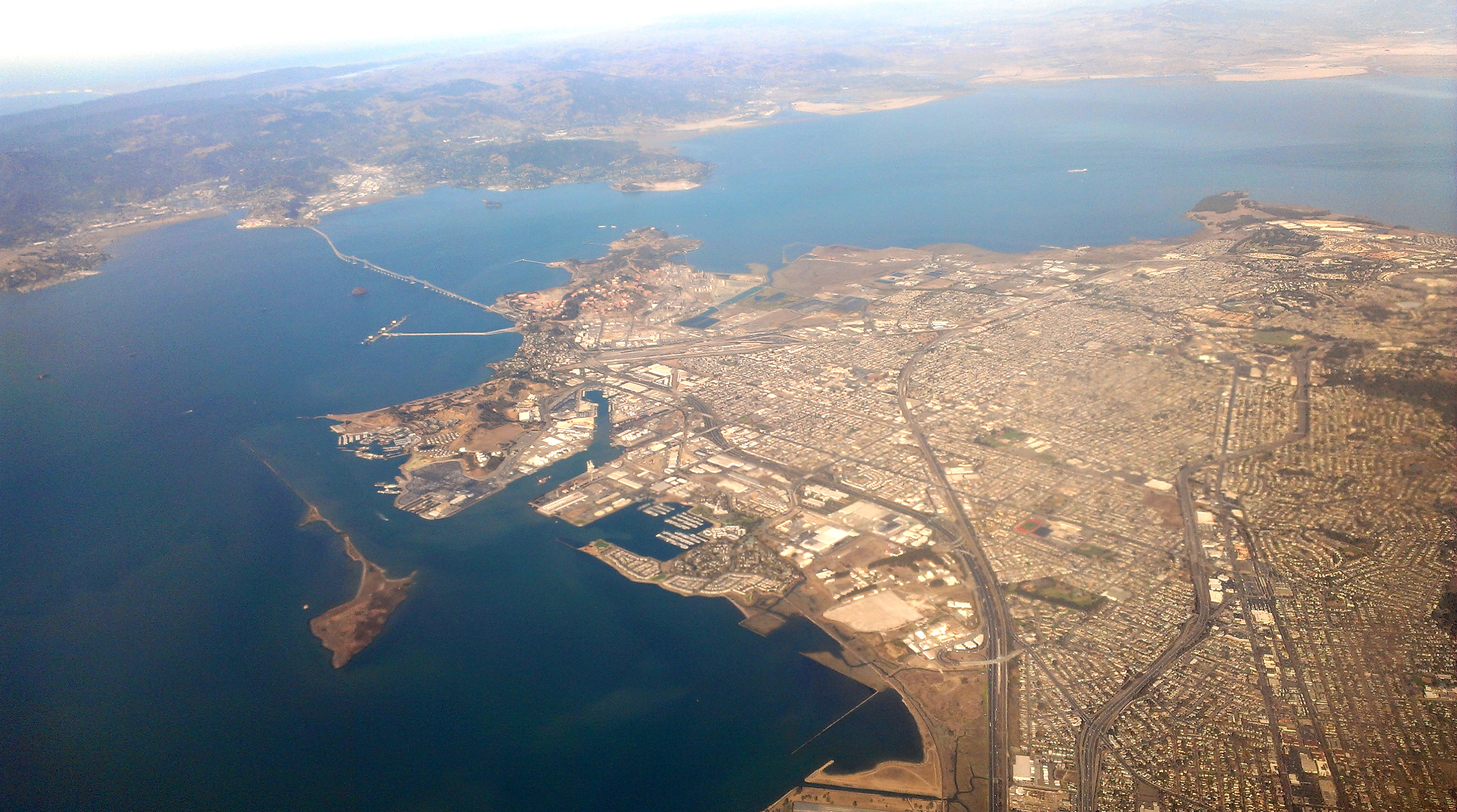
Hero · Pt. Richmond & Chevron Refinery, 2016 · Audiohifi · CC BY-SA 3.0
The assignment
Hold the whole peninsula.
This is not a Chamber brochure. Not a Rosie nostalgia reel. It is a chronicle of Richmond — written as a land story, sister to the West Oakland page, with a separate spine. Richmond content stays here.
The shoreline was cared for before the survey lines. Rancho San Pablo became Santa Fe terminus and Standard Oil. Kaiser yards pulled Southern families into a boomtown that segregated its own housing. Macdonald Avenue hosted a Ku Klux Klan Independence Day spectacle in 1924 — named here as confirmed civic shame, not soft-pedaled. The Kaiser “summit vision” from Easter Hill stays oral / legend — quarry and overlook are confirmed; the epiphany story is not. Chevron never left. Point Molate swung from wine to Navy fuel to casino fight to parkland. Now OpenAI’s lease sits on Harbour Way South — recorded, mayor-reported, company-silent.
The assignment is to love the land and name the pressure: who dug the fill, who breathed the flares, who gets the next bay door. Rumor is not lease. Lease is not company announce. Oral legend is not quarry fact.
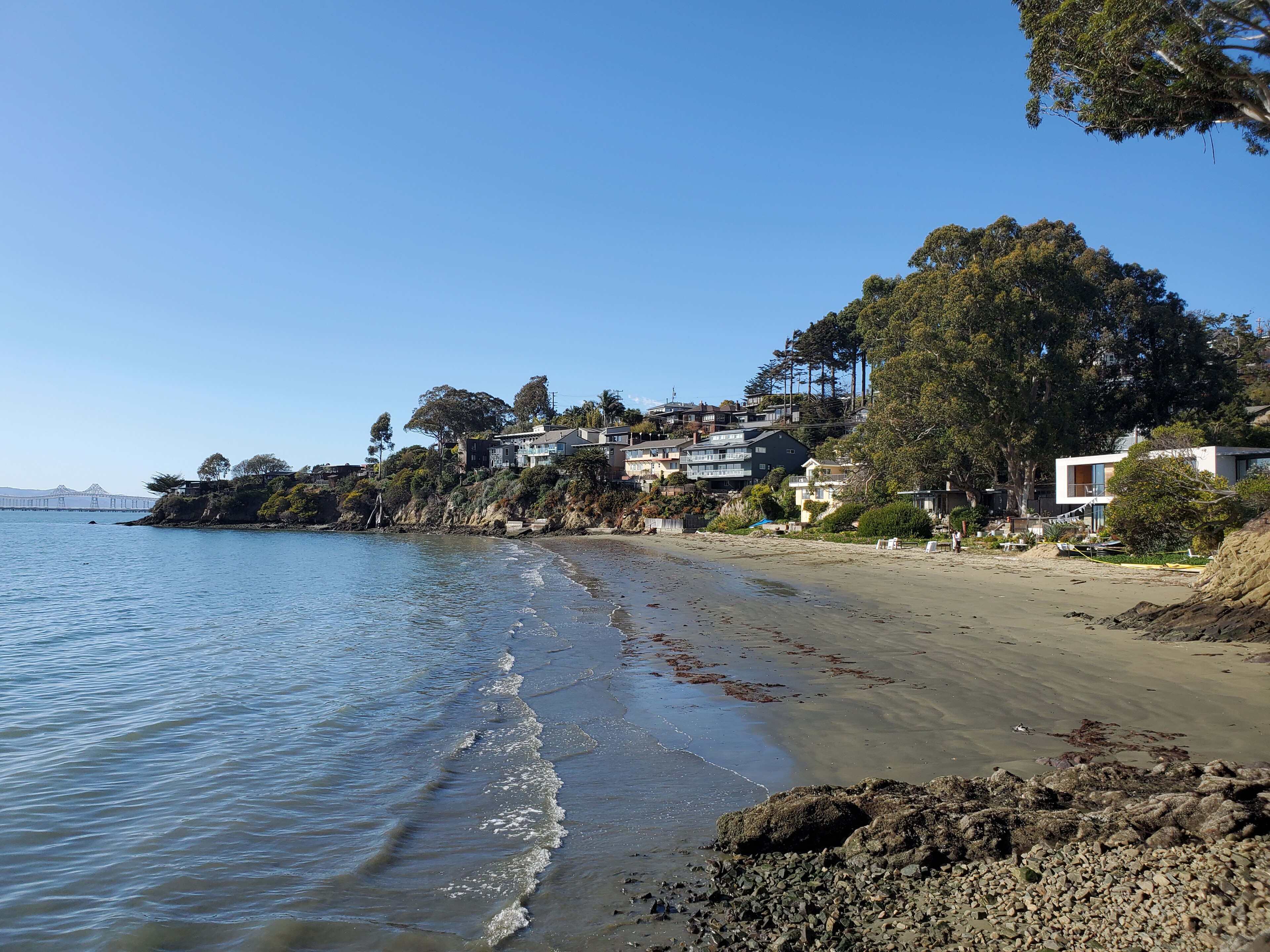
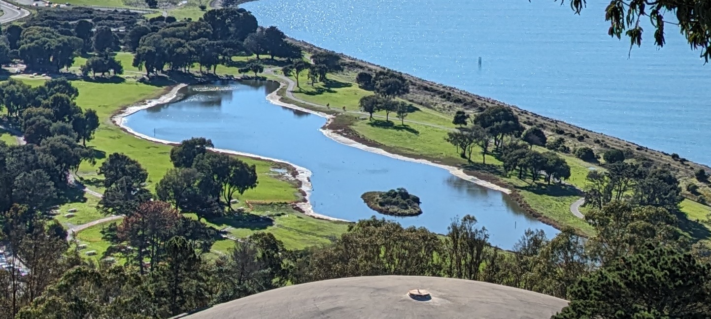
Ambient · Cypress Point shoreline, Miller/Knox, 2021 · Pi.1415926535 · CC BY-SA 4.0
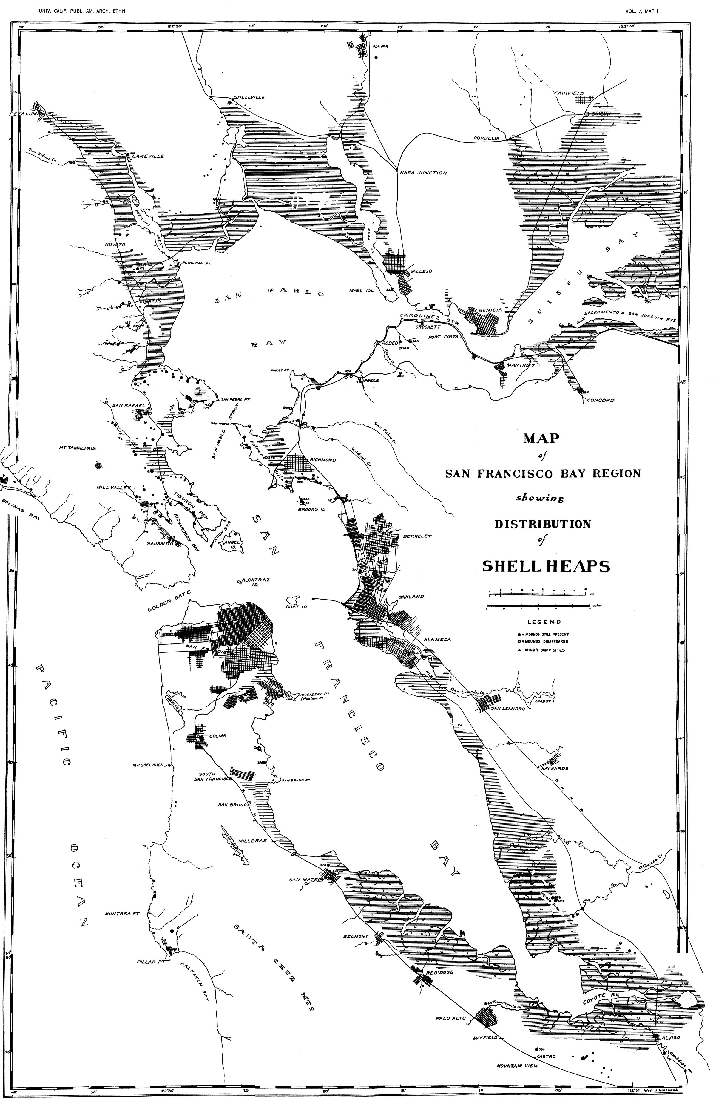
Richmond’s peninsula sits on ancestral territory of the Huchiun / Huichin — Chochenyo-speaking Ohlone people whose maritime life threaded roughly thirty-two miles of shoreline the city later claimed. Shellmounds marked gathering, ceremony, and continuity along San Francisco Bay and San Pablo Bay. Many mounds were destroyed by fill, rail, and industry. What remains is archaeology plus living nations — not a tourism map.
“Ohlone” is an umbrella. Local ethnography points to Huchiun/Huichin on this stretch. Confederated Villages of Lisjan, Muwekma, and related Ohlone political presence continue in the present tense. Ookwe Park and shellmound remembrance are not preface — they are unfinished business on the same water.
Any honest Richmond chronicle starts here: the deep water that later made the port possible was never empty. It was cared for, interrupted, remapped.
Cypress Point shoreline, 2021 · Pi.1415926535 · CC BY-SA 4.0 — living Bay edge
Primary · Nels C. Nelson shellmound distribution map, 1909 · Public domain — historic geography, not a living portrait
02Chapter 021772 Spanish recon · Mexican grant · American survey
Rancho San Pablo.
Fages and Crespi passed in 1772. Mission cattle ranch “San Ysidro of the Juchiunes” thickened into the Castro Rancho San Pablo — roughly 17,000 acres in the grant era around 1823. Secularization and American survey did not end the Indigenous story; they remapped labor and dispossession onto the same hills and marshes.
The name “Richmond” lands via Edmund Randolph’s affection for Richmond, Virginia, onto 1850s coastal survey maps; later railroad maps carry “Point Richmond.” Love the land first: peninsula between San Francisco Bay and San Pablo Bay; Potrero hills; marshes; the deep water that will later make industry inevitable.
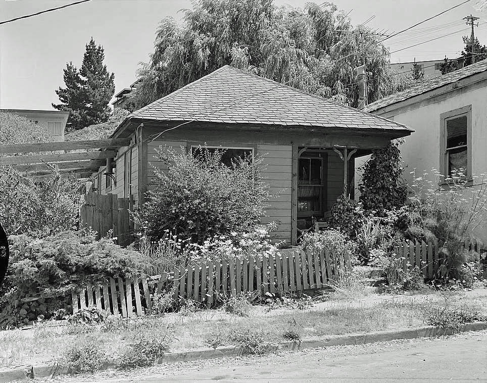
Point Richmond’s historic fabric stands in for early town memory where a clean rancho-era map with clear reuse rights was not available for this pass. The map that named the place still sits under every later lease.
Point Richmond Historic District, 35 Contra Costa St., 1982 · Ed Andersen, HABS / NPS · Public domain
03Chapter 031895 — 1919 · Santa Fe terminus · Standard Oil · Winehaven
Rails, oil, boomtown.
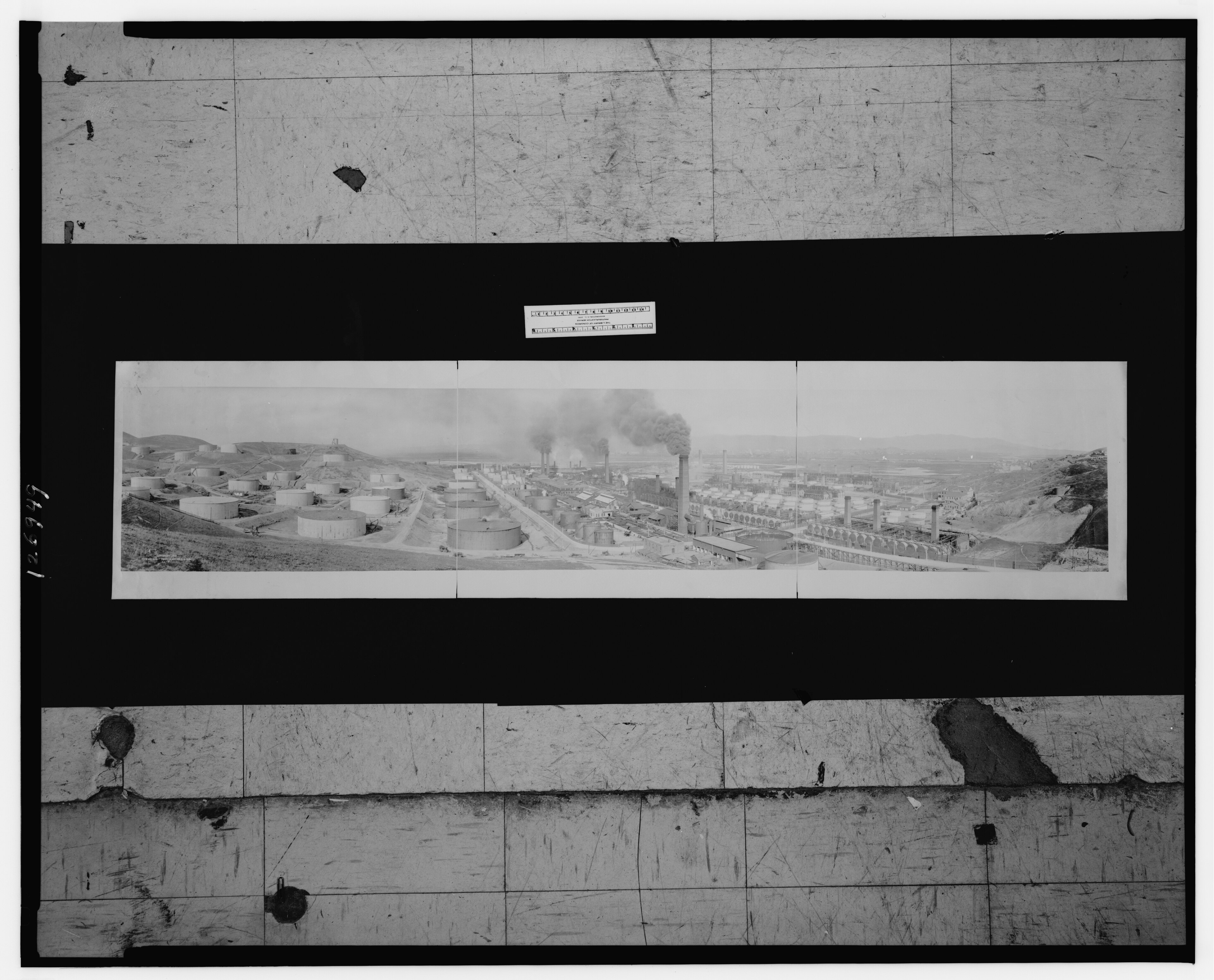
Augustin S. Macdonald pitched Santa Fe’s western terminus at Point Richmond. First overland train and Ferry Point service arrived around 1900; shops and yard reshaped the Potrero. Pacific Coast Oil / Standard Oil built the refinery in 1901–02 under William Rheem. Richmond incorporated in 1905 with roughly 2,100–2,150 people — company-town gravity from the start.
Parallel industries stacked the shoreline: Winehaven (California Wine Association after the 1906 quake — claimed largest U.S. winery until Prohibition around 1919; later NRHP village); a Chinese shrimp camp at Point Molate (~1870–1912) closed by racist fishery laws and bag-net bans — name the violence, not just “industry.” Pullman Palace Car shops (~1910) made Richmond a west-of-Mississippi repair hub. Boosters said “Pittsburgh of the West.” Saloons, brothels, and labor fights shared the same paragraphs.
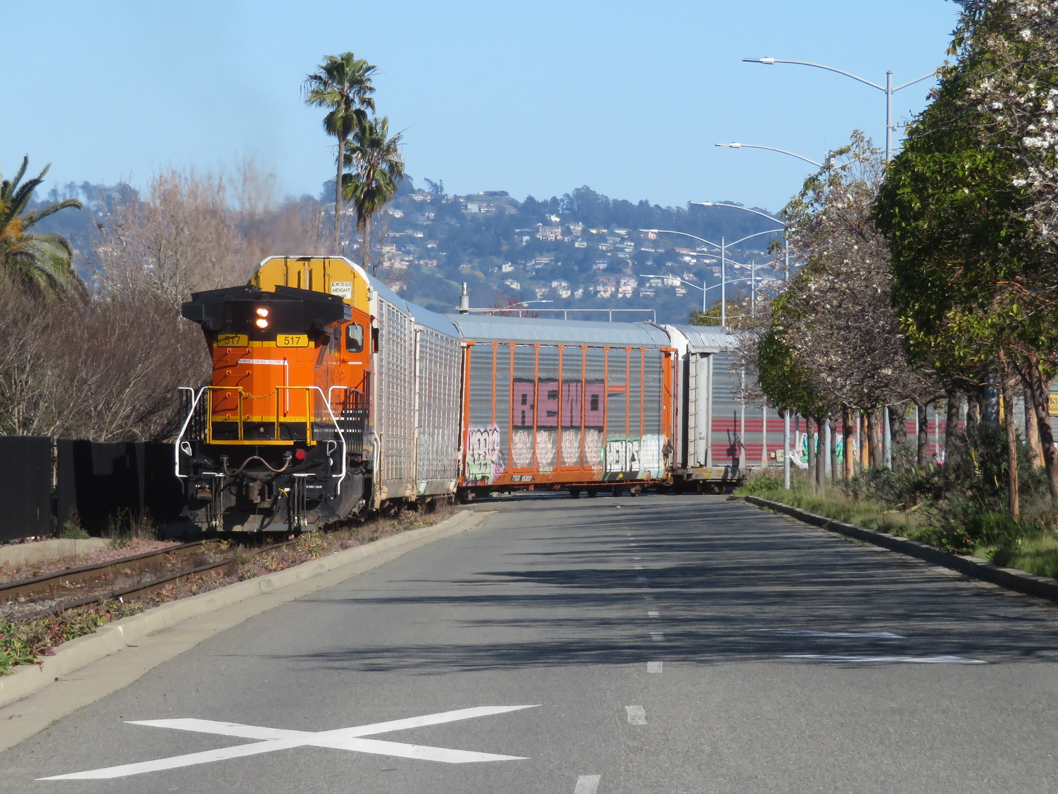
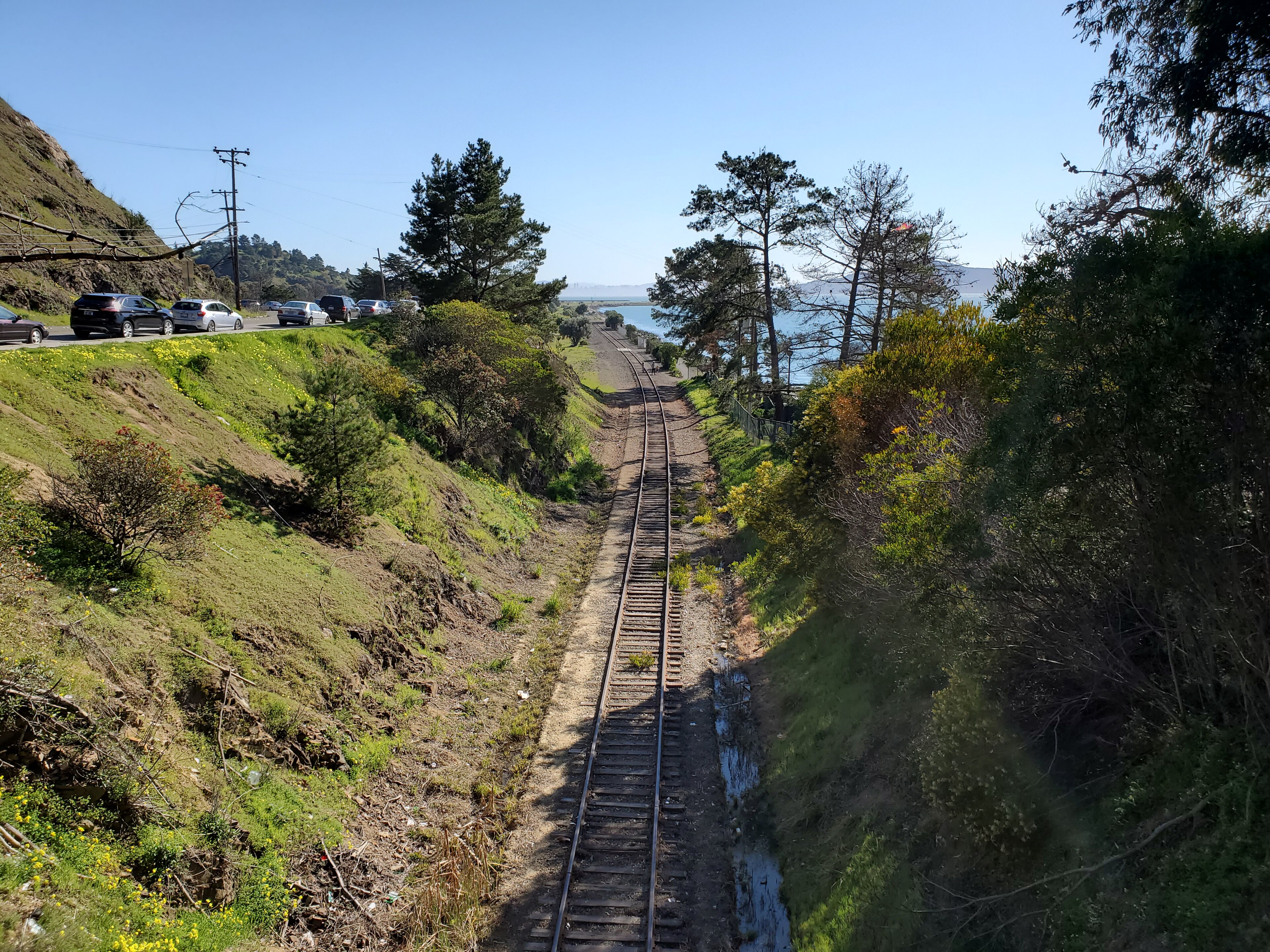
BNSF at Cutting Blvd, 2021 · Pi.1415926535 · CC BY-SA 4.0Disused tracks, Ferry Point, 2021 · Pi.1415926535 · CC BY-SA 4.0
Primary · General view, Standard Oil Company, Richmond, 1913 · Library of Congress · Public domain
04Chapter 04~1907 — 1940 · Port · Ford · Macdonald Ave Klan 1924
Port, Ford, Macdonald.
Harbor dredging, bonds, and tideland fill made the Port of Richmond a deepwater node. Ford’s Assembly Plant opened around 1930–31 — Albert Kahn’s “daylight factory” — becoming the city’s third-largest employer behind Standard Oil and Santa Fe; later a WWII Tank Depot. Downtown Macdonald Avenue and Hotel Carquinez anchored civic life. The Iron Triangle is named for three railroad tracks that bound it — map first, metaphor second.
Prewar Black and Mexican railroad communities existed before the wartime Southern wave — Shirley Ann Wilson Moore’s To Place Our Deeds is the spine text. Population hovered near 23,600 by 1940; African American population around 270 (Moore-line / Richmond Confidential figures).
CONFIRMED · July 4, 1924: Ku Klux Klan contingents marched in Richmond’s Independence Day parade down Macdonald Avenue. No Klan-robe hero image on this page — the event is named in prose. Headcount conflicts in the record: Bastin’s Richmond Independent review cites ~750; SF Chronicle / secondary lit cite ~3,000. Do not pick a favorite. Contingents from Oakland, San Francisco, San Jose, Vallejo, Santa Rosa — Bastin: no Richmond contingent. How they entered the parade remains partly unclear (Oakland permit revoked; Allied War Veterans invitation with no-masks condition vs city permitting gap). “Richmond was a Klan town” is not established — Bastin argues the photo does not prove local klavern depth. Name the spectacle; do not invent the stronghold.
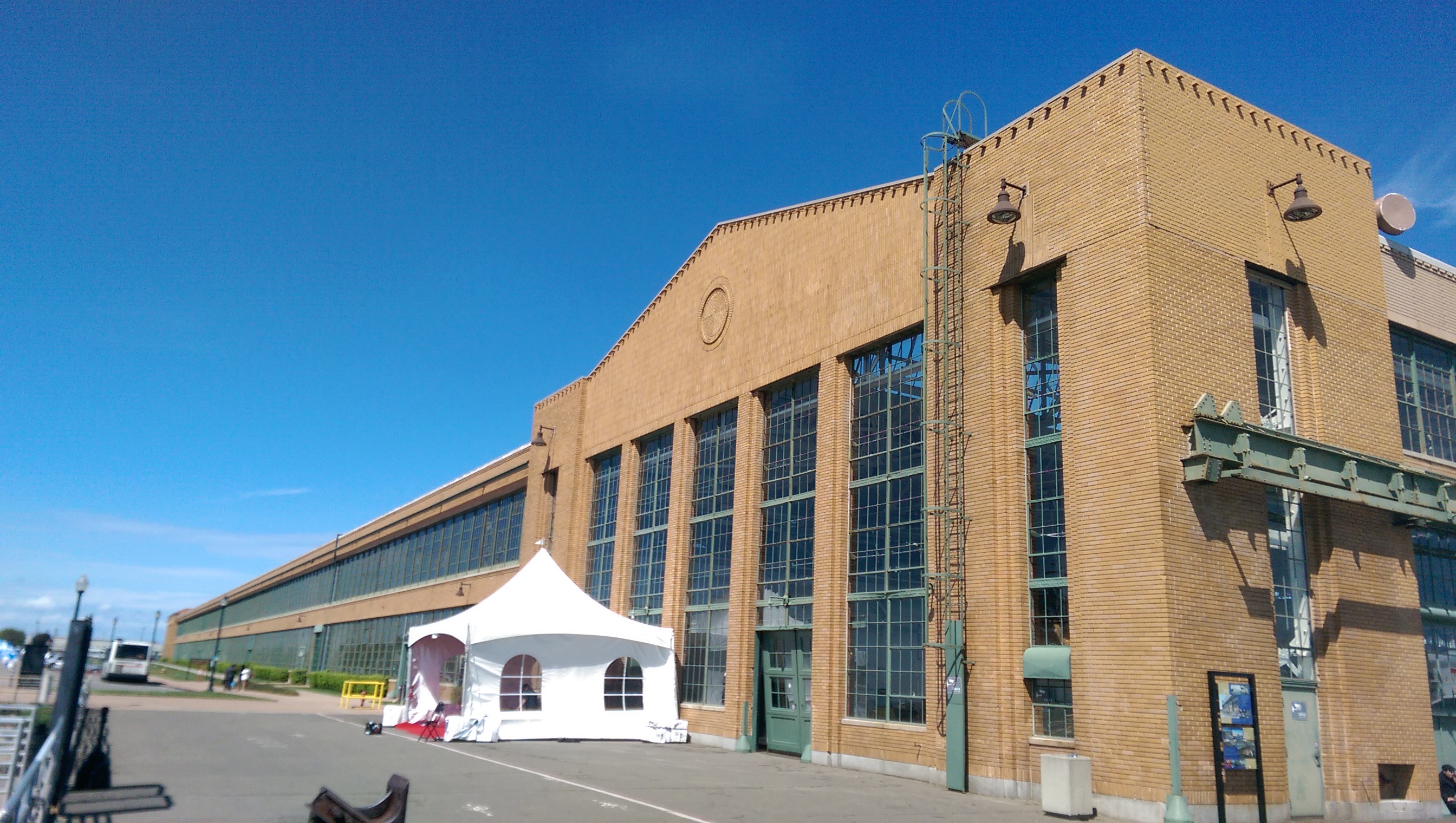
Ford Richmond Assembly Plant, 2014 · Cullen328 · CC0 — industrial chapter beat; Macdonald Klan beat held in prose only
05Chapter 051940 — 1945 · Kaiser yards · Rosie · Southern influx · Easter Hill
Kaiser & the wartime city.
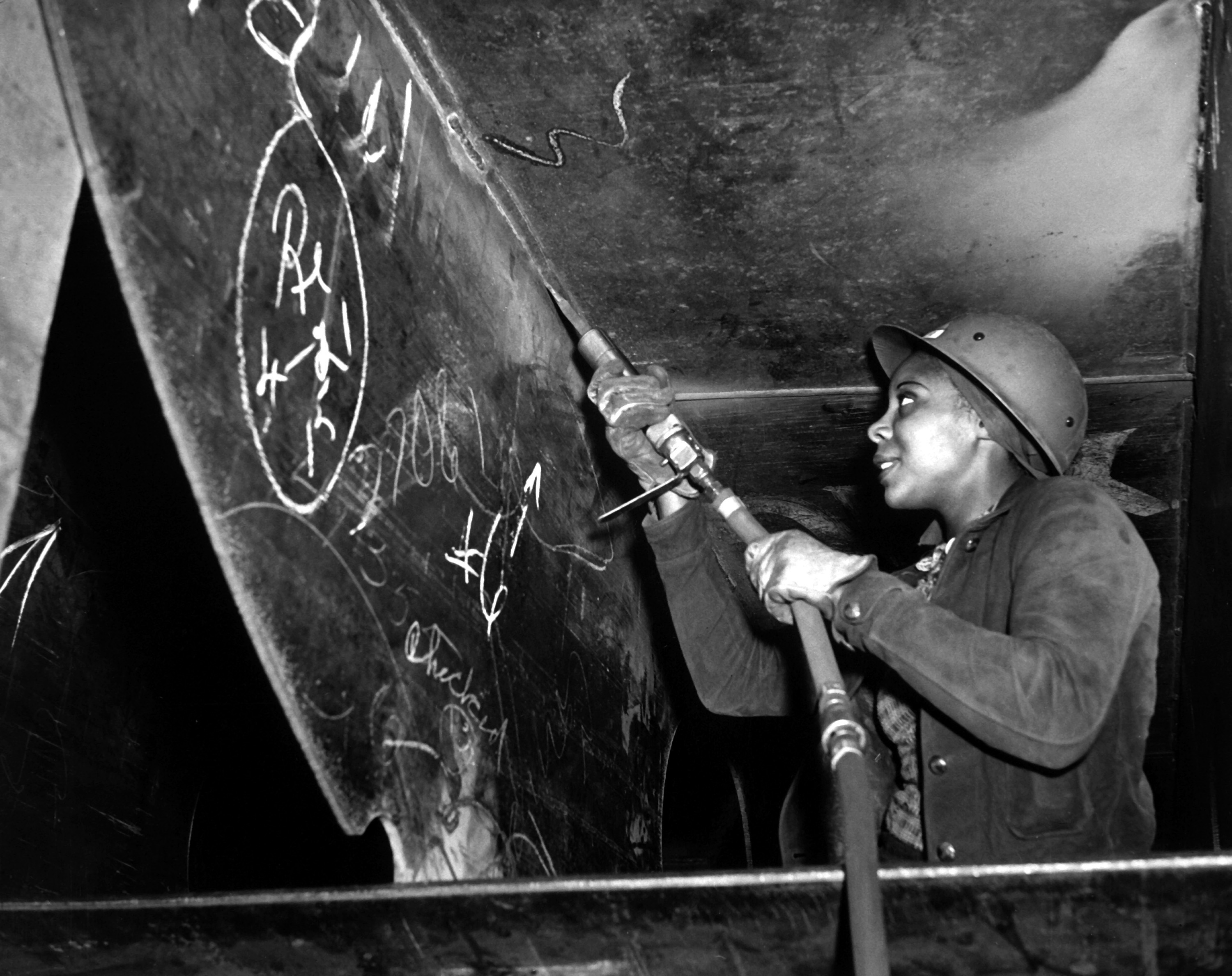
Confirmed Four Kaiser Richmond yards launched on the order of 747 Liberty/Victory and other vessels (NPS / HAER — slight 745–747 variance across docs). Prefab and assembly-line welding made “Wendy the Welder” as true as Rosie. Population exploded from roughly 23–24 thousand to a wartime peak commonly placed between ~94k and ~110k depending on the year cited.
Confirmed · Richmond-specific Kaiser / Permanente recruiting pulled Black and white workers from Texas, Louisiana, Mississippi, Oklahoma (and broader Southeast / Southwest). City of Richmond Black History Corner and Moore document the geography. Black population moved from hundreds (~270 prewar) into the thousands by war’s end. This is a Richmond rewrite — Kaiser yards, Richmond war housing, Iron Triangle / North Richmond / “the L,” Moore’s community, Rosie NHP as a Richmond site. No West Oakland corridor paste.
Confirmed Federal and local war housing was explicitly segregated. Black workers were steered to shoddier and temporary units nearer yards and rail; white workers farther inland toward existing white neighborhoods. Harbor Gate and other Lanham Act projects are named geography. Boilermakers auxiliaries were segregated. NPS Rosie the Riveter / WWII Home Front NHP commemorates; this chronicle keeps segregation and toxicity in frame.
UnverifiedOral / legend
Easter Hill “summit vision”: The anecdote that Henry J. Kaiser stood on Easter Hill and envisioned Richmond’s shoreline as a wartime shipyard is not written as fact here — no primary citation found in NPS, HAER, Gilford, Calisphere captions, or Hardison interview digests this pass.
Confirmed geography Easter Hill (formerly Little Cerrito / Cerrito; ~150 ft; Easter sunrise-service popular geography) was quarried by the Kaiser combine for fill to build the yards — “great big quarry” in Hardison’s telling. A November 1943 Bancroft pictorial shows Yard 4 looking south from Easter Hill — proving overlook during operations, not a documented summit epiphany. Postwar Easter Hill Village (Hardison + DeMars + Halprin) rose on the scarred site. Prefer: from what remained of the hill you could see Yard 4. No invented summit photo on this page (Yard-4-from-hill rights were unclear for download).
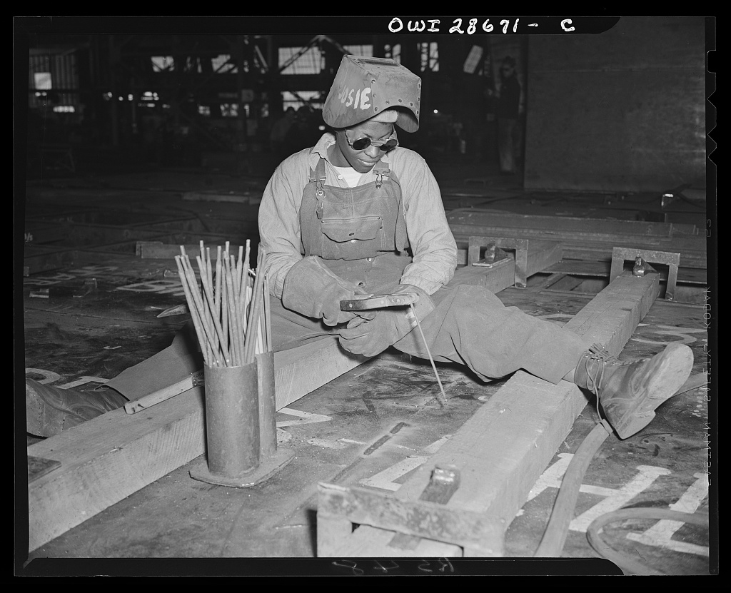
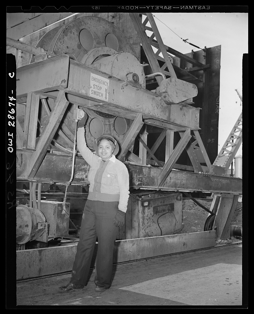
Josie Lucille Owens, welder-trainee, 1943 · E. F. Joseph / OWI · PDOdie Mae Embry, crane switch · E. F. Joseph / OWI · PD
Primary · Eastine Cowner, scaler, SS George Washington Carver, Kaiser Richmond, 1943 · E. F. Joseph / OWI · Public domain
06Chapter 061945 — 1960s · Housing · North Richmond · Parchester · the “L”
After the yards — housing.
Photo-lightNo PD/CC housing still
Shipyards closed. Population crashed. Redevelopment cleared “temporary” housing — Harbor Gate and kin — and warehouses replaced yards. Demolition hit Black-majority temporary stock hardest (Habitat EBSV / Moore-line fair-housing historiography).
The “L” — oral geography of where Black residents were told they could live along North Richmond and the Cutting corridor — maps structural neglect, not accident. North Richmond’s unincorporated status made the abandonment easier to ignore (Richmond Confidential + Moore).
FHA and redlining finance built white suburbs such as Rollingwood. The 1952 Wilbur Gary Rollingwood cross-burning (APEN timeline — San Pablo unincorporated; sheriff refused protection) sits on the postwar terror geography adjacent to Richmond’s housing map. Parchester Village (~1950) — Rev. Guthrie Williams and Fred Parr — advertised “homes for all,” then quickly became a majority-Black middle-class foothold after white flight (KQED and related).
Ford left for Milpitas in 1955. Pullman closed in 1959. Standard Oil / Chevron remained the constant employer-polluter-taxpayer. The 1924 Macdonald Klan march (Ch.04) is not re-litigated here — one street, long memory.
No rights-cleared Parchester / North Richmond housing photograph available this pass — prose holds the beat. Calisphere “copyright unknown” rejects stay off-page.
07Chapter 071902 — present · fenceline · 2012 fire · 2026 HRA
Refinery city.
Standard became Socal became Chevron (1984). Isocracking and petrochemical expansion, a research campus along 580, Long Wharf and Bay Trail lease fights — the plant is permanence. Fenceline reality: asthma, flares, sulfur-crude debates. Communities for a Better Environment, APEN, Urban Tilth, Richmond Our Power Coalition — organizers as protagonists, not color commentary.
Confirmed On August 6, 2012, a crude-unit fire sent roughly 15,000+ people seeking medical care. CSB corrosion findings followed. Town halls stacked “no explosions” corporate lines against resident testimony — label each voice. Political arc: Richmond Progressive Alliance / Gayle McLaughlin era settlements, utility audits, Measure T fights, property-tax wins — one of the few California cities that treated the refinery as adversary and paycheck at once.
Air District · preliminary On August 25, 2026, the Bay Area Air Quality Management District released a preliminary health risk assessment for the Chevron Richmond Refinery under Rule 11-18. Maximum modeled lifetime cancer risk: 37 in a million (action threshold: 10 in a million). Short-term non-cancer risk also above threshold; long-term non-cancer below. About 74% of the cancer risk is attributed to benzo[a]pyrene from fittings and tanks; short-term risk is driven largely by benzene from wastewater treatment (bio-reactor). This is a worst-case model for nearby residents — not an average Richmond risk and not a finding that “37 more people in a million will get cancer.” Company pushback Chevron said the assessment has “significant issues” and “materially overstate[s]” emissions and modeled risk. Public comment closes November 23, 2026, 5 p.m. Air District public meeting: Monday, September 21, 2026, 5:00 p.m., Richmond Memorial Auditorium & Convention Center (403 Civic Center Plaza per BAAQMD; Richmondside has listed 440). If the preliminary findings hold, Chevron must submit a risk-reduction plan or install best available retrofit toxics controls — plan also goes to public comment. (BAAQMD Aug 25, 2026; Richmondside / KQED Aug 26; Richmondside briefs Sep 4.)
No 2012 fire disaster-porn hero on this page. The plant on San Pablo Bay is enough — beauty and burden in the same frame.
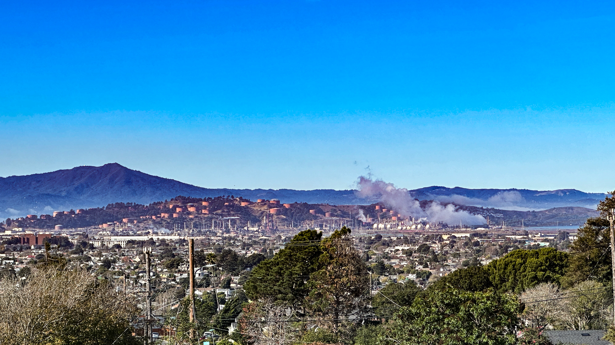
Chevron & Mt. Tam, 2023 · Bastique / Cary Bass-Deschenes · CC BY-SA 4.0
Primary · Richmond Chevron with San Pablo Bay from Nicholl Knob, 2023 · Bastique / Cary Bass-Deschenes · CC BY-SA 4.0
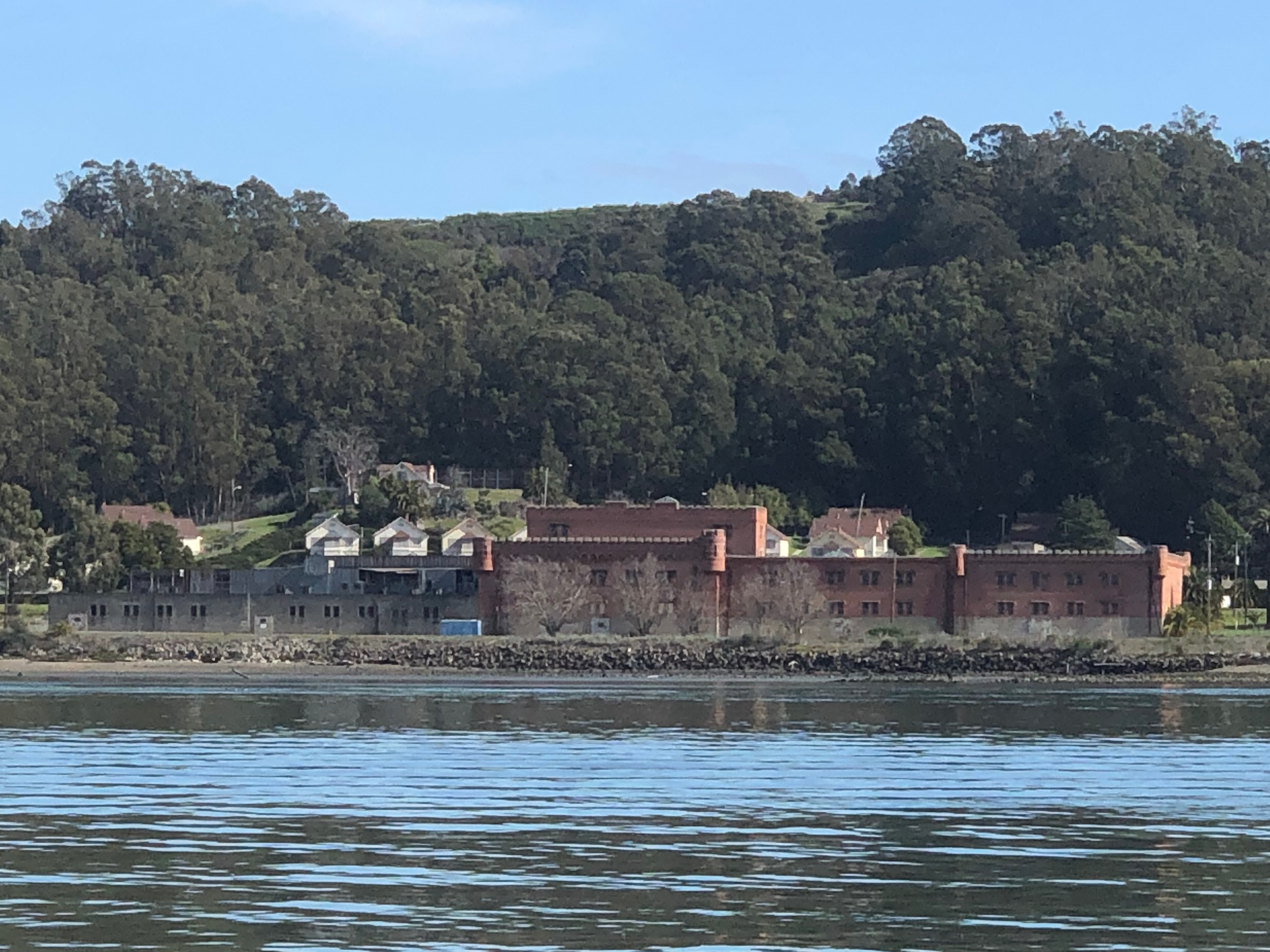
Winehaven mothballed under Prohibition, then became a Navy Fuel Depot (1941–1995) feeding the Pacific Fleet via Chevron pipeline. Surplus transfer gave the City the tract for about a dollar in the early 2000s. Casino/resort plans with Guidiville Rancheria and Upstream/Levine met Measure U (Nov 2010) advisory defeat (~58% no); Council killed the project in 2011; federal litigation dragged to a ~2018 settlement ending the casino claim.
Housing and open-space deals followed, then a park turn: East Bay Regional Park District acquired 82 acres in August 2025 (~$40M from Guidiville, Coastal Conservancy, and related funds). Bay Trail extension is under construction; public access targeted around 2027.
Keep Guidiville’s Pomo homeland distinct from local Ohlone stewardship claims — do not collapse tribes into one “Native casino” cartoon. Chinese shrimp-camp violence (Ch.03) still sits under the same water.
Winehaven from the water, Point Molate, 2020 · Dreamyshade · CC BY-SA 4.0
Hilltop Mall (1976) drained downtown retail. Knox Freeway / I-580 completed in the early 1990s. Richmond Parkway opened northwest industrial land. Marina Bay rose on old shipyard fill — waterfront living on wartime land; who gets the view is the quiet question.
Demography remade the city: Black plurality gave way to a declining Black share and growing Latino and Asian/Pacific Islander communities (Laotian/Mien and API environmental-justice threads via APEN). Crime narratives fought resident reclaiming — Pogo Park, East Bay Center / Iron Triangle Theater — chronicle the naming fight without punching down.
In 2020, Macdonald Avenue street painting (REPARATIONS NOW) explicitly recalled the 1924 Klan parade route — memory politics, not decoration.
City remap
Freeways, mall, parkway — retail and industrial gravity pulled away from Macdonald’s old spine.
Alfred Twu · CC0 · 2015
Marina Bay
Shipyard fill become waterfront address. Soft reopen of contested ground.
Alfred Twu · CC0 · 2015
Shoreline reclaim
Miller/Knox and Bay Trail adjacency — public water after industrial monopoly.
Mx. Granger · CC0 · 2023
Primary · Richmond southern shoreline & Marina Bay aerial crop, 2015 · Alfred Twu (Firstcultural) · CC0
Recurring pattern: ballot tax → lawsuit → settlement. In 2024 a $550 million / 10-year deal dropped a refining-tax ballot measure. Make Polluters Pay / CBE–APEN leverage sat opposite split community reaction — some call it a win, some call it pennies against a multi-decade tax fight.
Chevron remains roughly the largest taxpayer and employer (~3,000 workers; about 24% of general fund in FY24–25 per Richmondside reporting). Dependence is the plot. “Just transition” rhetoric shares the air with a still-operating West Coast giant above 250,000 barrels per day. Leave the argument open.
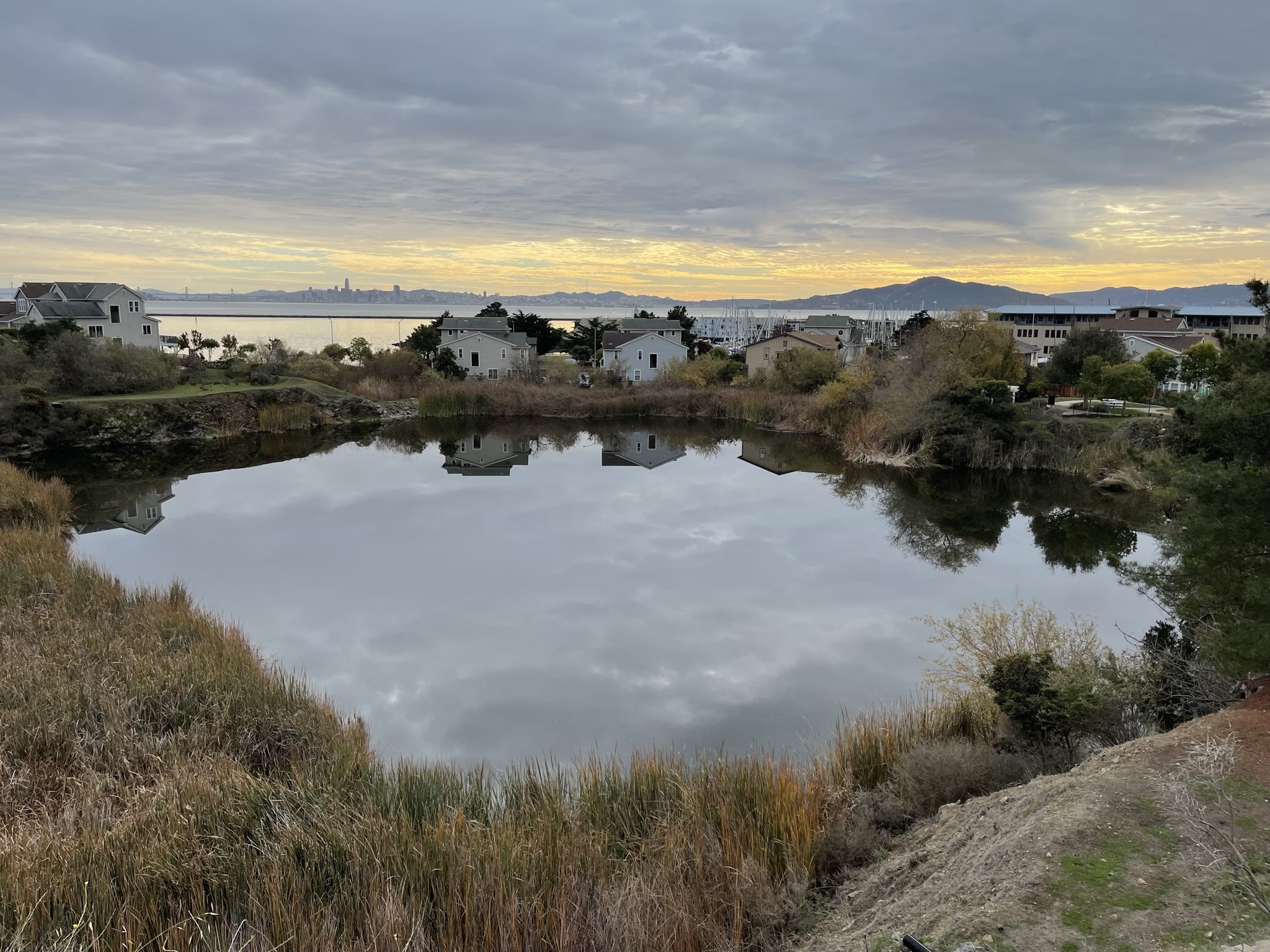
The shoreline at Brickyard Cove looks soft at sunset. The ledger underneath does not.
Brickyard Cove Pond with San Francisco & Angel Island at sunset, 2022 · Bastique · CC BY-SA 4.0
11Chapter 112024 — 2026+ · Harbour Way South · Portside · OpenAI
Harbour Way / Portside.
Same land that held shrimp camp → Winehaven → Navy fuel → shipyard fill → Ford orbit → now AI robotics rent. This chapter lives only on the Richmond sister — never on West Oakland.
Lease confirmed Contra Costa County record: OpenAI OpCo LLC lease recorded March 9, 2026 for 1411 Harbour Way South, Portside Commerce Center (~202,371 sq ft / ~15.75 acres), Terminal 3 east of the ferry. Brookfield is master lessee; OpenAI subleases all of it (Port Director Charles Gerard to press).
Mayor-reported Mayor Eduardo Martinez and Gerard confirm a company coming. Intended use, per Gerard’s understanding: operational software/hardware development and testing — not a data center. Figures of ~730 jobs, 24/7 ops, ~$75M annual city tax + ~$34M indirect are projections the mayor attributes to OpenAI — Chamber says no confirmation from the company.
Company silent OpenAI PR silent in Richmondside attempts. Not a public company white paper. Business Insider (Jan 2026) reported SF robotics lab + Richmond as second site / job postings — treat as investigative reporting.
Prior tenant context: Building built for Moxion Power (battery startup; vacated / bankrupt August 2024). Nearby: Viridi in the former Ford plant; Mossbridge / data-center interest at Point Potrero General Warehouse remains closed-session fog — parked until confirmed.
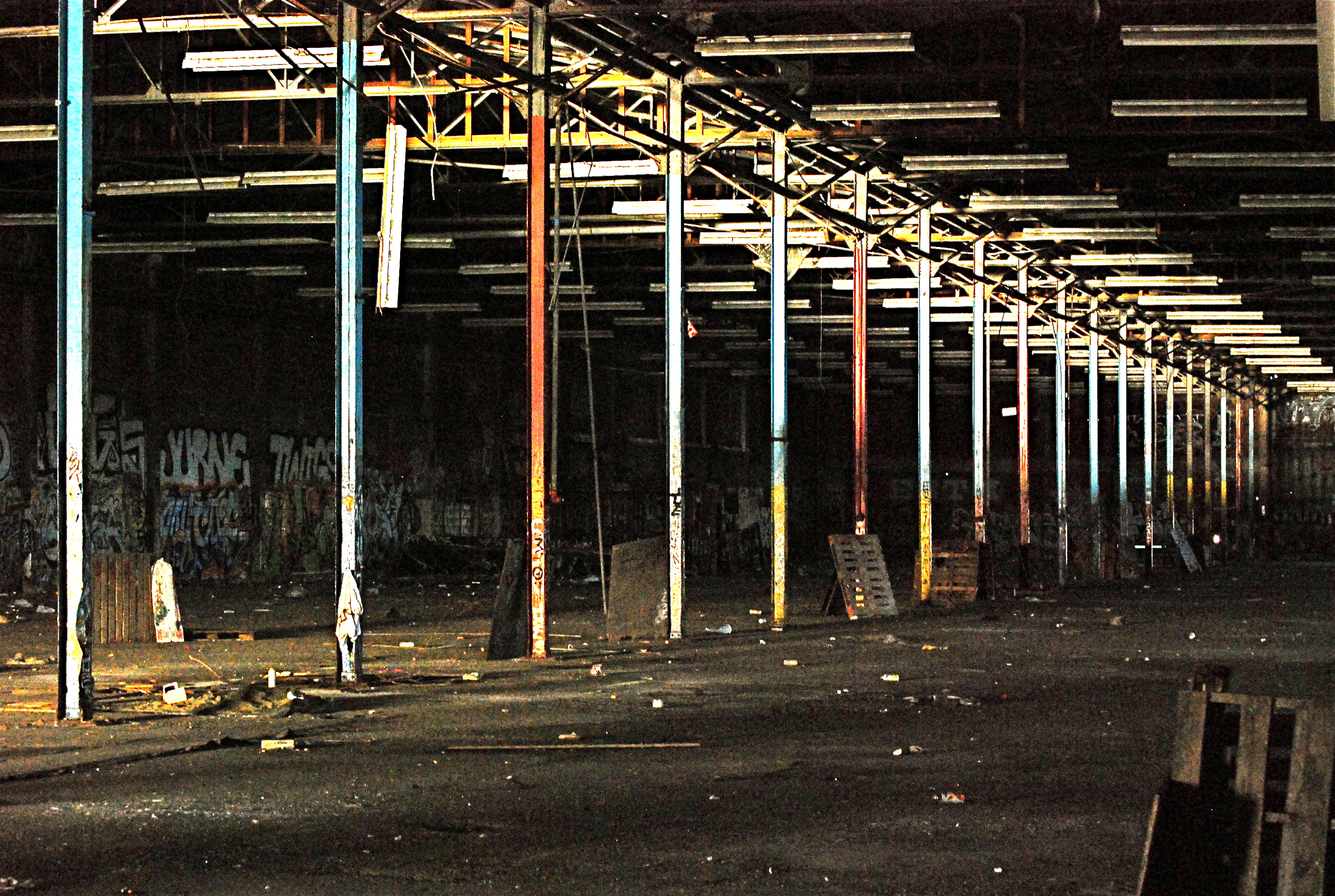
Empty warehouse texture, 2010 · nick fullerton · CC BY 2.0 — industrial edge, not Harbour Way itself
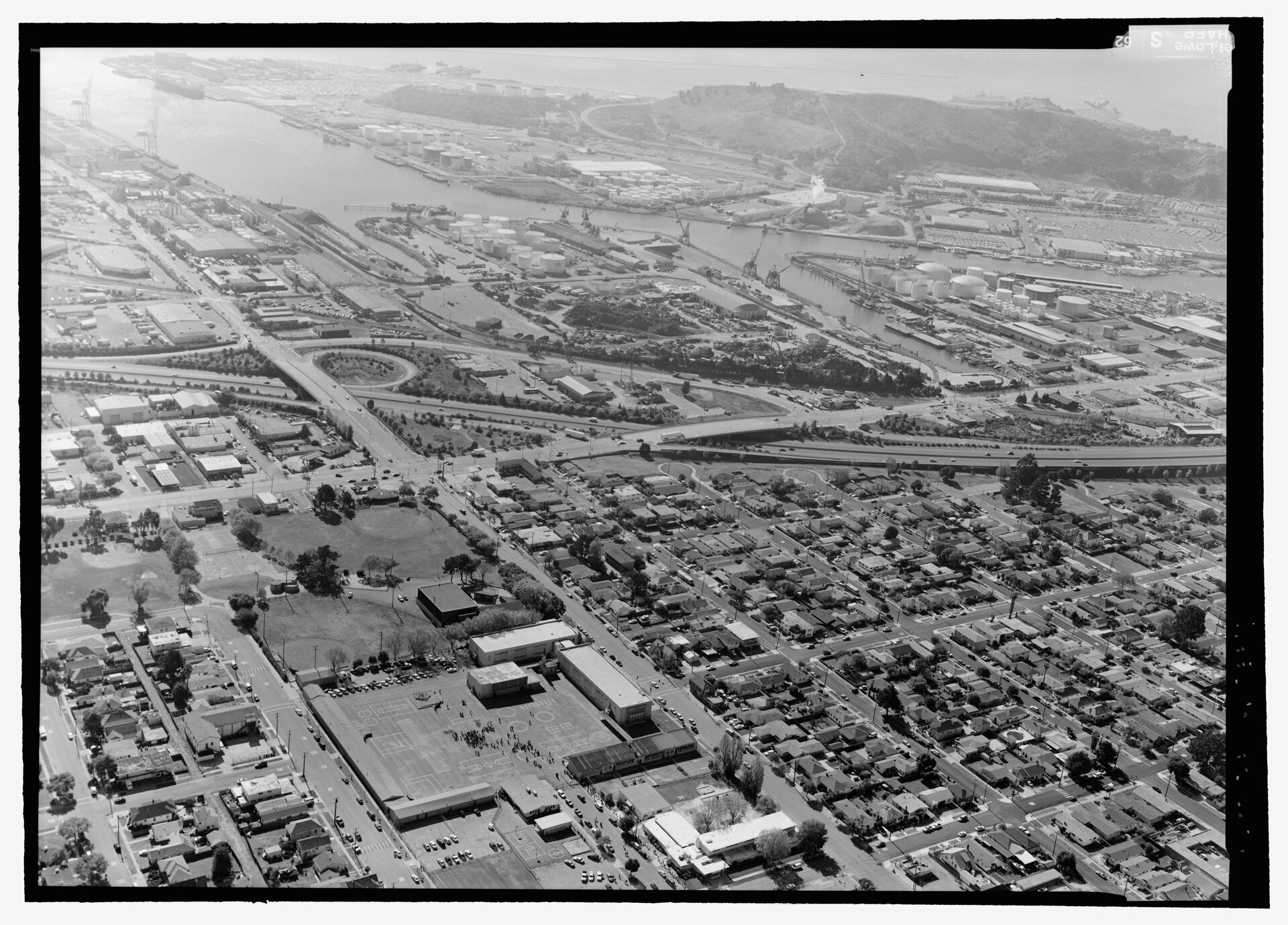
Primary · Harbour Way with Richmond Shipyard No. 3, HAER CA-326-4, 2004 · Jet Lowe, HAER / NPS · Public domain
On the pad · not yet history
What comes next.
Open items only. Nothing here is settled until the lease disclosure, the company statement, or the park gate says so.
1411 Harbour Way SouthLease confirmed
OpenAI Portside ops
Follow first hire wave, use confirmation beyond Gerard’s understanding, and any public OpenAI statement. Jobs / tax figures stay mayor-reported until the company or city file hardens them.
Point MolatePark acquisition
EBRPD access ~2027
Bay Trail extension and public access targeting. Keep Guidiville and local Ohlone stewardship claims distinct in every update.
Chevron / Rule 11-18Preliminary HRA
Cancer-risk comment window
Sep 21 Air District meeting (5 p.m., Memorial Auditorium). Comment closes Nov 23. Watch final HRA numbers and any required risk-reduction plan — preliminary is not final; company disputes the model.
Chevron / citySettlement era
$550M decade watch
Track whether the 10-year deal softens or hardens fenceline organizing. Just-transition rhetoric vs still-running barrels — leave the argument open.
Port / Point PotreroParked
Mossbridge / data-center fog
Closed-session negotiation noise only. No chapter upgrade until paper.
Richmond timeline · selected beats
The dense log.
Harms included. Soft language where sources disagree. Chronicle spine, not encyclopedia.
Before the city
Ongoing
Huchiun / Chochenyo caretaking
Shellmound shoreline life; living Lisjan / Muwekma continuity after mission and rancho rupture.
1772 — 1905
1772
Fages / Crespi pass
Spanish recon over future Rancho San Pablo lands.
~1823
Rancho San Pablo grant era
Castro holdings ~17,000 acres; Indigenous labor continues under new maps.
Dispossession
1900–05
Santa Fe terminus · Standard Oil · incorporation
Ferry Point service; Rheem refinery 1901–02; city incorporates 1905 (~2,100 people).
1924 — 1945
4 Jul 1924
KKK marches Macdonald Avenue
Confirmed Independence Day parade spectacle. Headcount conflict (~750 vs ~3,000). No Richmond contingent per Bastin.
Harm · confirmed
1930–31
Ford Assembly Plant opens
Albert Kahn daylight factory; later WWII Tank Depot.
1940–45
Kaiser yards · Southern influx · Easter Hill
~747 vessels; population ~23k→~94–110k peak; recruiting from TX/LA/MS/OK; Black population from hundreds into thousands; Lanham Act segregation. Easter Hill quarry/overlook confirmed; Kaiser “summit vision” oral/legend — not primary fact.
Boom · harm · labeled
1945 — 2012
1945–60s
Yards close · the “L” · Parchester
Temporary housing cleared; North Richmond neglect; Parchester ~1950; Ford exits 1955; Pullman 1959.
Displacement
1952
Wilbur Gary Rollingwood cross-burning
Postwar terror geography adjacent to Richmond’s housing map (APEN timeline).
Terror
6 Aug 2012
Chevron crude-unit fire
~15,000+ seeking care; CSB corrosion findings; corporate vs resident testimony.
Disaster
2010 — 2026
2010–18
Point Molate casino defeat → settlement
Measure U advisory no (~58%); Council kill 2011; federal end ~2018.
2024
Chevron $550M / 10-year settlement
Ballot tax dropped; split community reaction; dependence remains the plot.
Aug 2025
EBRPD acquires 82 acres at Point Molate
Park turn; Bay Trail access targeted ~2027.
9 Mar 2026
OpenAI OpCo LLC lease recorded — Harbour Way South
1411 Harbour Way / Portside. Lease confirmed. Jobs/tax mayor-reported. Company silent in local press attempts.
Open · labeled
25 Aug 2026
BAAQMD preliminary HRA — Chevron Richmond
Max modeled cancer risk 37/million (action at 10). Short-term non-cancer above threshold. Comment to Nov 23; meeting Sep 21. Company disputes. Preliminary, not final.
Air District · open
Cite lightly
Sources & reading.
No invented quotes or precision where the record only offers ranges. Start here; verify before you argue.
Shirley Ann Wilson Moore, To Place Our Deeds (UC Press) — spine text for Black Richmond
City of Richmond — History; Black History Corner (Kaiser Southern recruiting TX/LA/MS/OK)
NPS Rosie the Riveter / WWII Home Front NHP; HAER CA-326-L Kaiser Shipyards
Donald Bastin, “The Klan in Richmond,” Richmond Museum Assoc. Mirror Fall 2009
SF Chronicle OursF — Bay Area KKK / Richmond July 4 1924 parade